A powerful cold front has swept into Southern California, delivering a potent mix of heavy rainfall and unstable atmospheric conditions that have triggered widespread flood warnings across the Los Angeles basin. The National Weather Service (NWS) has issued urgent alerts, with meteorologists specifically highlighting the extreme danger posed to recent wildfire burn areas, where the combination of rainfall rates and soil instability has created a critical environment for life-threatening debris flows.
Key Highlights
- NWS Alert Status: The National Weather Service has upgraded flood warnings as rain bands intensify, focusing on areas with reduced vegetation and unstable slopes.
- Debris Flow Threat: Burn scars are currently the primary concern, as fire-ravaged soil lacks the root structure to hold ground, leading to catastrophic mudslides.
- Rainfall Thresholds: Meteorologists are monitoring precipitation rates closely, as sustained heavy rain can quickly overwhelm compromised drainage infrastructure.
- Evacuation Readiness: Residents in identified high-risk zones are being urged to maintain a ‘ready-to-go’ status as conditions remain fluid.
The Anatomy of the SoCal Storm: Hydrophobic Soils and Debris Risks
The current meteorological event is characterized by a cold, moisture-rich front that has stalled over the Transverse Ranges. Unlike a standard winter storm, this system is bringing high-intensity bursts of precipitation. For the average urban resident, this means localized ponding and traffic hazards. However, for those living near the perimeters of recent fire zones, this precipitation represents a geophysical threat known as a debris flow.
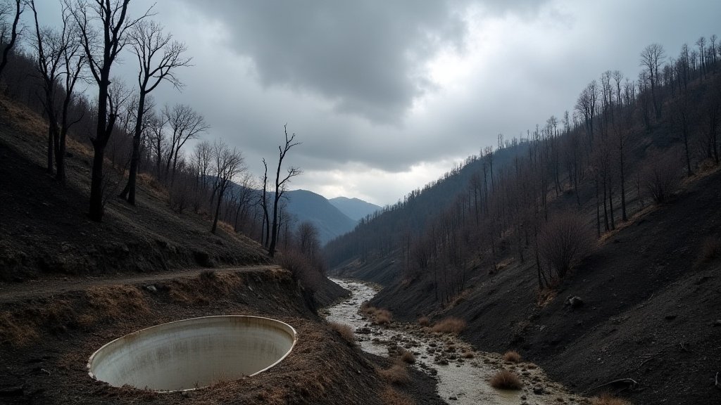
When a wildfire consumes vegetation, it often creates a ‘hydrophobic’ layer on the soil. The intense heat vaporizes organic compounds in the plants, which then condense into a waxy, water-repellent seal just below the surface. Consequently, when heavy rain arrives, the water cannot penetrate the earth to hydrate the ground. Instead, it sheet-flows over the surface, picking up ash, charred timber, boulders, and loose sediment. This slurry gains momentum, transforming into a fast-moving, high-density debris flow capable of destroying homes, blocking canyons, and severing critical transportation arteries.
Meteorological Protocols: Understanding NWS Alerts
The National Weather Service employs a tiered warning system that is vital during events like this. A ‘Flood Watch’ indicates that conditions are favorable for flooding, and residents should be prepared. A ‘Flood Warning’ or ‘Flash Flood Warning’ indicates that flooding is imminent or occurring. In the context of burn scars, the NWS often utilizes a lower threshold for triggering these warnings because the time from rainfall to debris flow in a fire zone is drastically shorter than in natural terrain. The precision of these alerts relies on rain gauges and Doppler radar networks that track the ‘precipitable water’ content of the incoming storm cells.
Geographic Vulnerabilities in the Basin
The Los Angeles geography—characterized by steep, fire-prone canyons surrounding urban sprawl—is uniquely susceptible to these phenomena. Water flows rapidly down these canyons, funneling toward residential neighborhoods at the base of the foothills. Historical data from events in the San Gabriel Mountains shows that even relatively modest storms can trigger significant sediment transport if the burn scar is sufficiently fresh. City engineers and flood control districts are currently on high alert, working to clear debris basins that catch runoff before it impacts populated zones, but these systems can fill rapidly under intense precipitation rates.
Secondary Angles: Infrastructure, Long-Term Adaptation, and Human Resilience
1. The Economic Burden of Climate Adaptation
The recurring nature of these storm-and-fire cycles is forcing a massive reallocation of municipal budgets. Beyond the immediate emergency response costs, the long-term economic impact is staggering. Millions of dollars are diverted annually to clear debris basins, repair roads undermined by runoff, and reinforce slope stability. This creates an ongoing economic strain on local governments, which must weigh the costs of preventative infrastructure against the unpredictable frequency of climate-driven events. Increasingly, insurance providers are also factoring these ‘wildfire-to-flood’ sequences into premiums, creating a complex financial landscape for homeowners in these transition zones.
2. Historical Context: The ‘Fire-Followed-By-Flood’ Phenomenon
This event is not an anomaly; it is a recurring environmental cycle in Southern California. Historical precedents, such as the catastrophic floods following the Station Fire, serve as grim reminders of the kinetic power of debris flows. These events teach us that the danger does not end when the fire is extinguished; the danger simply changes form. The ‘Fire-Flood’ sequence is a fundamental aspect of the region’s ecology, but human development has accelerated the conflict between urban areas and these natural, destructive processes.
3. The Psychological Impact on Residents
There is a profound psychological toll on communities that live on the ‘front lines’ of these cycles. Residents who have survived the anxiety of a wildfire often find themselves immediately transitioning into the anxiety of potential floods. This ‘double disaster’ reality leads to high levels of vigilance and fatigue. The ability of a community to maintain its ‘ready-to-go’ status for weeks or months at a time is a testament to the resilience of Southern Californians, but it also highlights the systemic stress placed on these communities by a changing climate.
FAQ: People Also Ask
Q: What is a debris flow, and how is it different from a mudslide?
A: While often used interchangeably, a debris flow is more violent and damaging. It is a mass movement of water, mud, rocks, and vegetation that flows like a liquid but carries the density of solid debris. It is significantly more dangerous than a standard mudslide due to its speed and the heavy debris it carries.
Q: Why do burn scars cause flooding so quickly?
A: As mentioned, the fire creates a hydrophobic, water-repellent layer on the soil. Additionally, the loss of vegetation eliminates the natural root system that would normally hold soil in place and slow down the flow of water. Without these barriers, rainfall turns into runoff immediately.
Q: How can I prepare for a flood alert in a burn area?
A: Keep a ‘Go-Bag’ packed with essential documents, medication, and supplies. Monitor NWS alerts, ensure your home’s drainage channels are clear of debris, and know your evacuation route. Do not wait for an official order if you feel your immediate area is becoming unsafe.
Q: How long does a burn scar remain a threat?
A: A burn scar is typically considered a high-risk flood zone for two to five years after a fire, or until native vegetation has sufficiently regrown to stabilize the slope and absorb water. Recovery times can vary significantly based on the severity of the fire and annual rainfall levels.