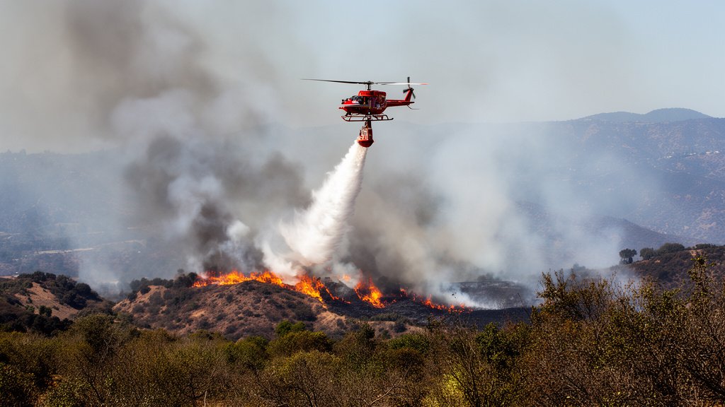
A fast-moving wildfire has been reported in Los Angeles County as of July 22, 2026, forcing emergency response teams into immediate action as the region faces critical fire weather conditions. Authorities are currently on the scene conducting initial assessments, with the situation remaining fluid and containment currently reported at zero percent. The blaze, which emerged mid-day, is drawing significant attention from local and state agencies as they work to establish a perimeter and protect the wildland-urban interface (WUI).
Key Highlights
• Official report confirms a new wildfire ignition in Los Angeles County on July 22, 2026.
• Containment status remains at 0% as ground and air crews establish incident command.
• Local authorities are currently conducting a rapid situation assessment to determine evacuation requirements and threat levels.
• Residents in the surrounding areas are urged to monitor emergency broadcast channels and official updates for potential evacuation warnings.
The Anatomy of a Rapid Response: Assessing the July 22 Blaze
The ignition of a wildfire within the sprawling geography of Los Angeles County represents a significant tactical challenge for the Los Angeles County Fire Department (LACoFD) and associated agencies. Because the county encompasses a complex mix of urban sprawl, residential neighborhoods, and rugged, high-risk mountainous terrain, the initial hours of any fire incident are characterized by a high-stakes race against time and topography. The current situation, reported as of July 22, 2026, places incident commanders in a position where they must prioritize the preservation of life and property while simultaneously managing the unpredictable behavior of the fire front.
Tactical Challenges and Resource Allocation
When a fire is first reported, the primary objective is rapid containment. This often involves a multi-pronged approach: the deployment of hand crews to cut fuel breaks, the utilization of heavy air tankers to drop retardant, and the strategic positioning of fire engines to defend structures. Because the containment is currently listed at zero percent, the incident is in its “initial attack” phase. During this phase, intelligence gathering is paramount. Incident commanders are likely utilizing aerial reconnaissance—thermal imaging drones and helicopter flyovers—to determine the fire’s rate of spread, direction, and intensity. This data is critical for assigning resources effectively, as the county must maintain a balance between aggressive suppression and ensuring the safety of personnel operating in difficult terrain.
The Impact of Environmental Variables
The timing of this wildfire—mid-July—coincides with peak seasonal risks for Southern California. The region’s environmental health, characterized by fluctuating fuel moisture levels, creates a volatile environment where even minor sparks can lead to rapid conflagration. Meteorological factors such as localized “micro-climates” within the canyons, humidity levels, and wind patterns play a decisive role in how the fire behaves. At this stage of the season, vegetation in many parts of the county has reached a critical level of dryness, turning chaparral and brush into highly efficient fuel sources. The current assessment by authorities likely includes a deep analysis of these fuel conditions, which directly dictates the strategy for containment lines.
The Wildland-Urban Interface (WUI) Factor
One of the most complex aspects of firefighting in Los Angeles County is the existence of the wildland-urban interface. As housing developments continue to push into historical fire-prone areas, the risk management strategy becomes increasingly multifaceted. Fire agencies must coordinate with local law enforcement to plan potential evacuation routes while simultaneously focusing on structural defense. This requires a seamless integration between the Incident Command System (ICS), local government infrastructure, and regional emergency alerting systems. The current situation necessitates that residents in or near the affected zone remain hyper-vigilant. Even if an evacuation order has not been issued, the lack of containment means that conditions could shift rapidly, requiring swift adaptation by all involved agencies.
Long-Term Implications for Emergency Preparedness
Beyond the immediate tactical response, this incident highlights the persistent vulnerability of the region. Historical data suggests that July is often a month where fire activity can escalate if weather patterns remain stagnant. For the community, this serves as a sober reminder of the necessity for “defensible space”—the practice of clearing vegetation around properties to prevent ember ignition. As authorities work to bring the July 22 blaze under control, post-incident analysis will likely focus on the ignition source, the effectiveness of the initial response, and how infrastructure—such as power grids or road networks—contributed to or hindered firefighting efforts. The economic impact, ranging from direct suppression costs to property value implications and air quality degradation, is a secondary concern that often lingers long after the flames are extinguished. For now, the priority remains strict adherence to the guidance of the Los Angeles County Fire Department and regional public safety officials.
FAQ: People Also Ask
1. What should I do if I see smoke or fire in my area?
If you see smoke or fire, do not attempt to investigate yourself. Move to a safe location, call 911 immediately, and provide as much detail as possible about the location and intensity of the fire. Monitor local emergency alerts for evacuation orders.
2. How can I track the containment status of the current LA wildfire?
Official containment updates are provided by the Los Angeles County Fire Department and relevant state fire agencies via their official social media channels and emergency alert websites. Avoid relying on unverified social media reports during the initial response phase.
3. What is the difference between an evacuation warning and an order?
A warning indicates potential danger and advises residents to prepare for immediate departure. An evacuation order is a mandatory instruction to leave the area immediately, as conditions have become or are becoming life-threatening.
4. Where can I find information on air quality during this wildfire?
Air quality reports can be found through the South Coast Air Quality Management District (SCAQMD) or national environmental databases, which provide real-time updates on particulate matter levels caused by smoke.