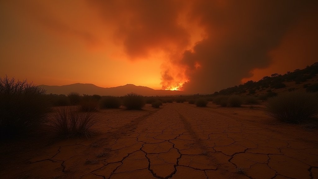
A wildfire, named the Summit Fire, has scorched at least 2,581 acres in Llano, California, prompting urgent evacuation orders. The blaze ignited on Friday afternoon near Jesus Canyon Road and East Avenue Z and rapidly expanded, exacerbated by the Southern California heatwave and critically dry conditions. A smoke advisory is in effect for portions of Los Angeles and Riverside counties, with concerns growing about air quality. Adding to the precarious situation, the region is bracing for potential monsoonal weather, which could bring lightning.
Key Highlights:
- Summit Fire has burned over 2,581 acres in Llano, CA.
- Evacuation orders are in effect for several zones.
- High temperatures and dry conditions are fueling the fire’s rapid spread.
- Monsoonal weather with potential lightning is forecast for the region.
- A separate “Allen Fire” in Lucerne Valley has involved structures and caused ammunition discharges.
Summit Fire Engulfs Llano Amidst Extreme Conditions
The Summit Fire erupted on Friday afternoon, quickly escalating from an initial 8-acre incident to a substantial blaze. By 10 p.m. on Friday, July 11, 2026, the fire had consumed an estimated 2,581 acres and remained at 0% containment, according to the California Department of Forestry and Fire Protection (CAL FIRE). The fire’s rapid growth is attributed to high temperatures, with the region experiencing mid-90s, and critically dry brush, which acts as fuel. The fire is burning near the Los Angeles-San Bernardino county line.
Evacuations and Shelters Established
Mandatory evacuation orders have been issued for specific zones, including LAC-E107 and LAC-E127-C, with residents urged to leave immediately. An evacuation shelter has been established at the Antelope Valley Family YMCA located at 43001 10th St. West in Lancaster. While authorities have stated that multiple structures are threatened, protection measures are reportedly in place. As of Friday evening, no injuries had been reported.
Monsoonal Threat and Air Quality Concerns
The wildfire is occurring as Southern California is preparing for the arrival of monsoonal moisture. This weather pattern is expected to bring a 10% to 20% chance of lightning to Los Angeles, Ventura, Santa Barbara, and San Luis Obispo counties, primarily in mountainous areas, starting Sunday and potentially lasting through Thursday. Meteorologists warn that this could increase wildfire risk due to the association of dry lightning and gusty outflow winds with these storm systems. A wildfire smoke advisory has been issued by the South Coast Air Quality Management District (AQMD) for parts of Los Angeles and Riverside counties. Residents are advised to monitor air quality conditions and stay indoors if they smell or see smoke.
Allen Fire Incidents in Lucerne Valley
Simultaneously, a separate brush fire, known as the Allen Fire, has broken out in Lucerne Valley. This blaze has involved structures, and firefighters have reported hearing ammunition discharging. The Allen Fire was reported around noon on Friday, July 10, 2026, near Sunset Road and Allen Way. Firefighters from the San Bernardino County Fire Protection District responded, noting that southern winds contributed to the fire’s rapid spread toward nearby homes. Reports indicate that power lines have fallen in the area, and one of the burning homes contained ammunition. By late Friday afternoon, authorities had lifted evacuation orders for the Allen Fire, which was halted at approximately 15 acres. However, earlier reports indicated it had grown rapidly from a quarter-acre to approximately five acres with structure involvement.
Historical Context and Future Outlook
The current fire activity in Southern California highlights a persistent challenge of wildfires in the region, often exacerbated by climate change-induced heatwaves and drought conditions. Historically, Southern California has faced significant wildfire seasons, with increasing intensity and frequency. The convergence of extreme heat, dry vegetation, and the potential for monsoonal thunderstorms creates a volatile environment. Future wildfire seasons are predicted to be more severe, necessitating ongoing investment in firefighting resources, community preparedness, and land management strategies. The proximity of these fires to populated areas underscores the critical need for effective early warning systems and robust evacuation plans.
FAQ: People Also Ask
What is the Summit Fire?
The Summit Fire is a wildfire that ignited on Friday afternoon in Llano, California, near Jesus Canyon Road and East Avenue Z. It has rapidly spread due to high temperatures and dry conditions, consuming over 2,500 acres and prompting evacuation orders.
Where is the Summit Fire located?
The Summit Fire is located in Llano, California, near the Los Angeles County and San Bernardino County line.
What is the current acreage of the Summit Fire?
As of Friday evening, July 11, 2026, the Summit Fire has burned an estimated 2,581 acres.
Are there any evacuation orders in place for the Summit Fire?
Yes, mandatory evacuation orders are in effect for specific zones, including LAC-E107 and LAC-E127-C.
What is the Allen Fire?
The Allen Fire is a separate brush fire that occurred in Lucerne Valley, California. It involved structures and led to ammunition discharges.